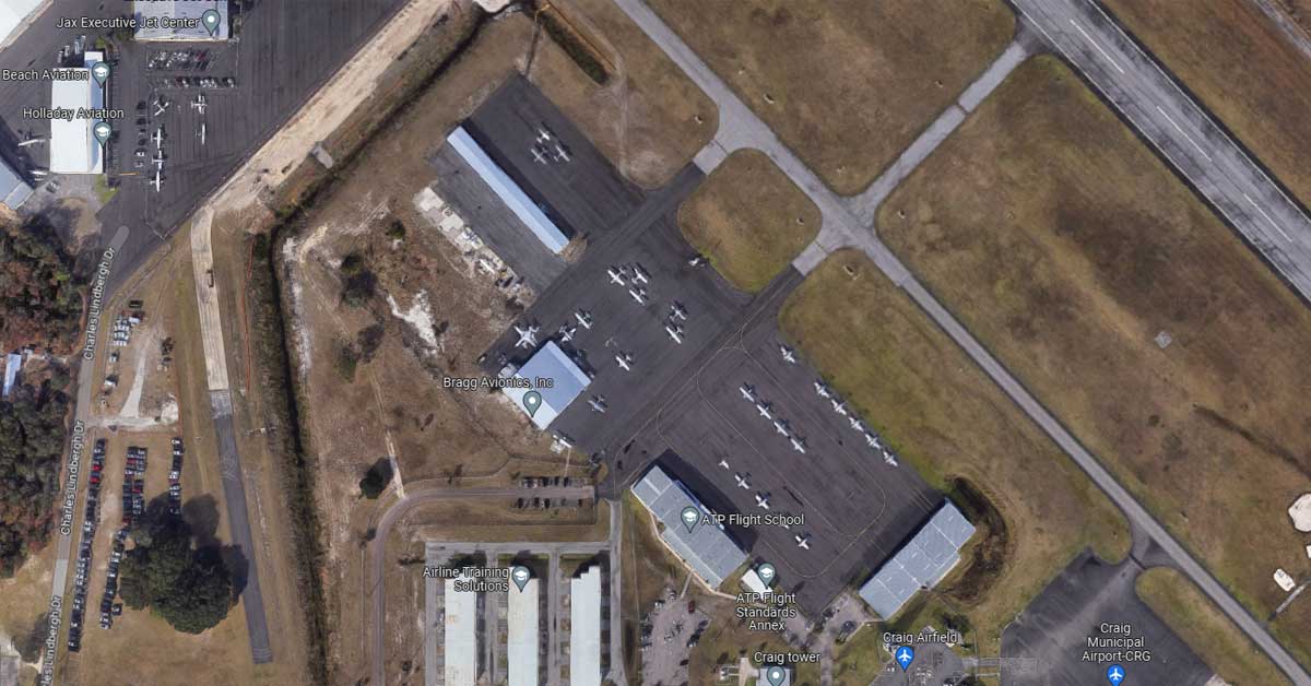
If you take a look at any satellite imagery from Google Maps, the only place you’ll see airplanes is at an airport. However, you’ll notice that they’re all parked or only visible if they’re on the tarmac. But for planes in the air, Google’s algorithm automatically removes these from view since Google Maps typically only focuses on static objects.
There are also instances where every airplane at specific airports are blurred-out or completely removed from satellite view. Why? Because either they’re airborne or edited out due to TSA’s strict security rules. Depending on the airport or terminal, you may even find no airplanes at all or a large blurred out area. The reasoning behind this is due to heighten security measures that keep the public from viewing airliners, especially those in or around military bases.
Non-Static Objects Removed from View
It’s common practice for Google to automatically edit-out moving objects from the Maps satellite view. Since this view is typically comprised of a combination of aerial photographs from airplanes and satellite imagery collected throughout the years, Google has an ingenious way to remove non-static objects such as moving airplanes, trains, etc. While cars would fit in this category, they’re very common and typically non-descript from a birds-eye-view, so there is little to no security reason to remove them.
But what explains random mosaic-like images that you may find at airports? See below:
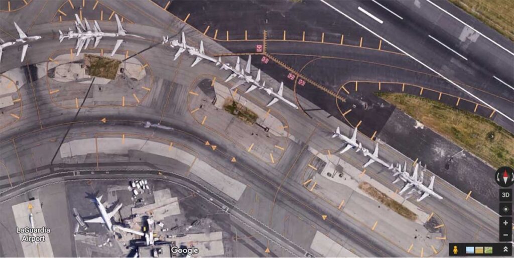
The screenshot above shows an airplane taking off from LaGuardia Civil Airport. As you’ll notice, the same plane appears roughly 18 times in seemingly random, half-legible format. Clearly, this is a prime example of the combination of imagery that wasn’t automatically fixed. While this screenshot is from several years ago, you’ll now see that this glitch is no longer visible.
The whole point of Google Maps is to map the static ground, not moving airplanes. That said, it’s not in the best interest for users to view planes that are in the air. But sometimes it happens on accident. See our next example:
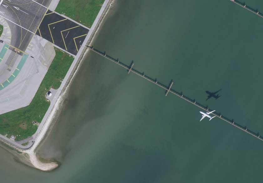
The above screenshot is near the runway at San Francisco International Airport. You can clearly see an airplane going in for landing, along with its shadow. This is an instance where Google’s algorithm didn’t automatically blur-out the incoming airplane. Apparently the algorithm missed this instance of a moving airplane flying through the air. This is a rare sighting that will likely (eventually) be filtered-out to blend in with the water. While the following video is a bit outdated and most airborne plane sightings are now gone, it shows specific examples of planes in flight on Google Earth.
Mystery Planes on Google Maps
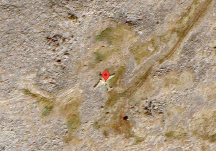
If you end up discovering a random plane on Google Maps, consider yourself lucky. It’s kind of like an easter egg hunt. For example, take a look at the following coordinates: 65.778281,-169.066704
Here, you will see a plane located in the center of Big Diomede in the Diomede Islands off the coast between Russia and Alaska. But take a close look. Is it airborne? No, the airplane is on the ground! In other words, it’s a static object. In fact, this is an old Soviet military plane was abandoned here in 1971. Pretty cool, isn’t it?
This isn’t the only example of an abandoned plane that’s visible on satellite view. However, one thing is clear; this plane has been sitting here for a long time. Have you found any other mystery planes on Google Maps? Let us know by dropping a comment below.
Meet Ry, “TechGuru,” a 36-year-old technology enthusiast with a deep passion for tech innovations. With extensive experience, he specializes in gaming hardware and software, and has expertise in gadgets, custom PCs, and audio.
Besides writing about tech and reviewing new products, he enjoys traveling, hiking, and photography. Committed to keeping up with the latest industry trends, he aims to guide readers in making informed tech decisions.